
WHY WALKING THE SITE STILL MATTERS: A PRACTICAL GUIDE TO WATERWAY ASSESSMENT
Written By Brendan Nielsen
Before any modelling software is opened, before any reports are drafted — the most important engineering tool is a pair of boots and a set of experienced eyes.
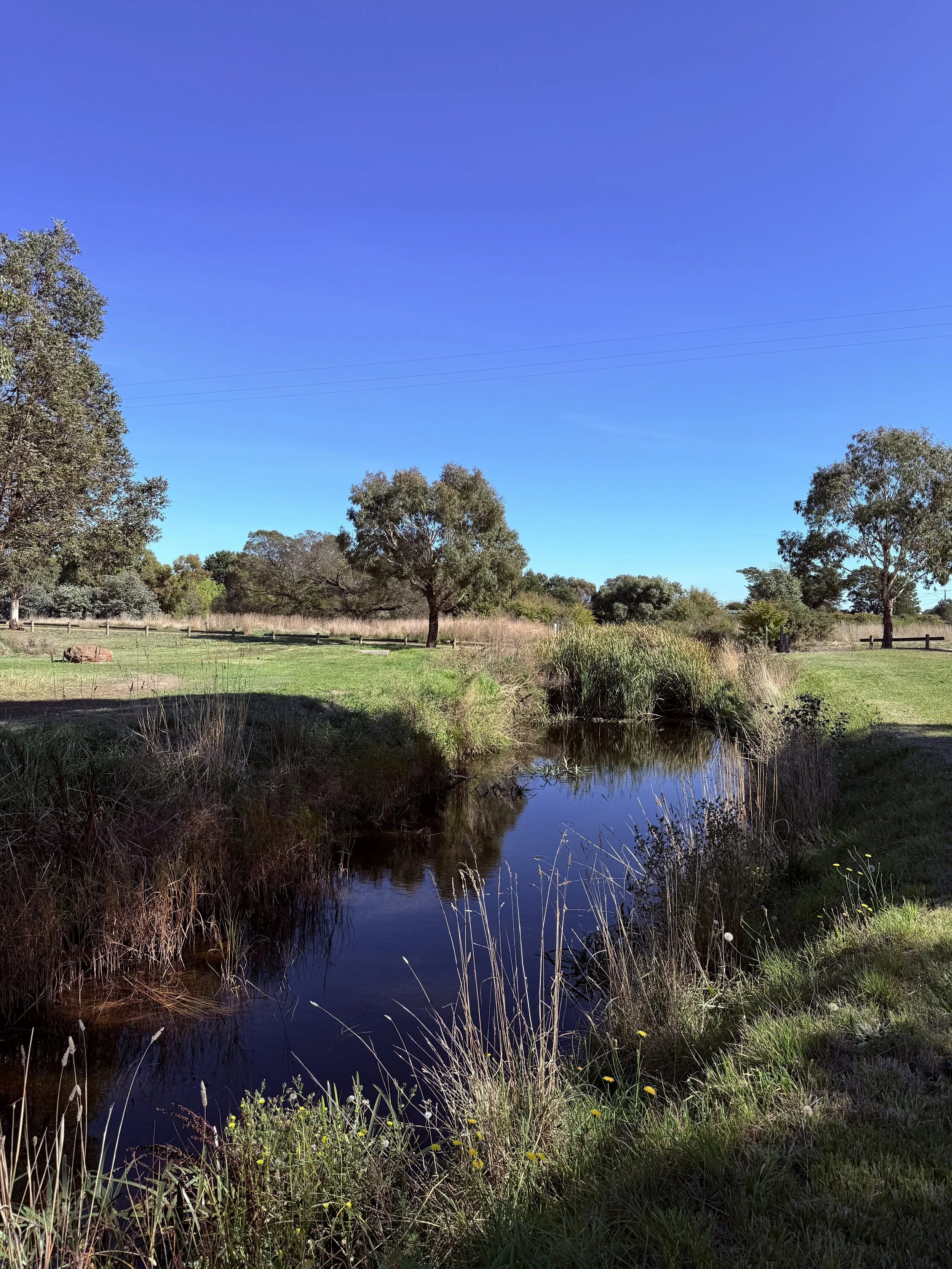
This waterway reach, photographed during a recent JCE site inspection in regional Victoria, is a good example of why desktop-only assessments miss critical information. Everything you need to start making sound engineering decisions is visible from the bank — if you know what to look for.
What Experienced Engineers See That Software Doesn't
When our team walks a waterway site, we're not just taking photos. We're reading the landscape.
Here's what a practical site assessment actually captures:
Flow behaviour. Where is the water moving? Where is it pooling? Are there signs of recent high-flow events — debris lines, scour marks, flattened vegetation? These observations tell you how the catchment actually behaves, not just how a model predicts it should.
Vegetation condition. Healthy riparian vegetation stabilises banks, filters runoff, and slows flow. Sparse or degraded vegetation signals erosion risk, water quality issues, and potential habitat concerns. You can see this from the bank. You can't see it from a contour map.
Bank stability. Are the banks holding? Is there undercutting, slumping, or exposed root systems? Early identification of bank instability avoids costly surprises during detailed design.
Access and constructability. If future works are needed, can you actually get equipment to the site? Are there fences, services, trees, or terrain that will affect construction staging? A 10-minute walk answers questions that take hours to resolve from a desk.
The Problem With Desktop-Only Assessments
Engineering technology has come a long way. LiDAR, GIS, and hydraulic modelling are powerful tools — and we use them every day.
But they have limits.
Models are only as good as their inputs. And inputs improve dramatically when the engineer who builds the model has actually stood on the site and observed how it works in the real world.
At JCE, we've seen projects where desktop-only assessments missed obvious site constraints — constraints that were immediately apparent on a 30-minute site walk. That's time and money wasted on redesign that could have been avoided.
Our common-sense rule is simple: walk the site before you open the software. Every time.
What Councils and Asset Owners Should Expect
If you're engaging an engineering consultant to assess waterway or drainage assets, the first deliverable should be a site visit — not a proposal full of modelling scope.
Practical questions your consultant should be answering on site include:
What is the waterway actually doing right now?
Are there visible signs of stress, erosion, or capacity issues?
What's changed since any previous assessments were done?
Are there access, environmental, or constructability constraints that will affect future works?
These observations shape everything that follows — from scope and methodology to budget and timeframe.
JCE's Approach
We don't believe in overcomplicating things. Our waterway and drainage assessments start with practical observation and common-sense engineering judgement. We use advanced tools when they add value — not as a substitute for being on site.
It's an approach that has served our clients well across Queensland, New South Wales, and Victoria. And it's why councils like the City of Ballarat continue to work with us.
👉 Talk to JC Engineers about your waterway or drainage project.